A one-hour getaway or a 20-day trip
Impressive Etoile and Garlaban massif, the vast inland sea of Berre: two unbuilt spaces around which cities, roads and rails wind. In the center, the Arbois plateau, wild and metropolitan.
Landscapes of Aix, Aubagne and Salon; town centers and housing estates; Marseille Piedmont; Gulf of Fos; Gardanne mining valley; Nerthe and La Fare chains…
So many worlds and countries make up the Provençal metropolis; so many landscapes and stories. The GR®2013 offers a great adventure over the 365 kilometers of this journey, in the footsteps of the artists-walkers who inspired this project. A path for everyone: for residents and tourists, for families and athletes, for artists and hikers…
The excursion around the Etang de Berre is the most interesting that one can do around Marseille.
_Paul Ruat, founder of the Société des Excursionnistes Marseille, 1899
The Topoguide

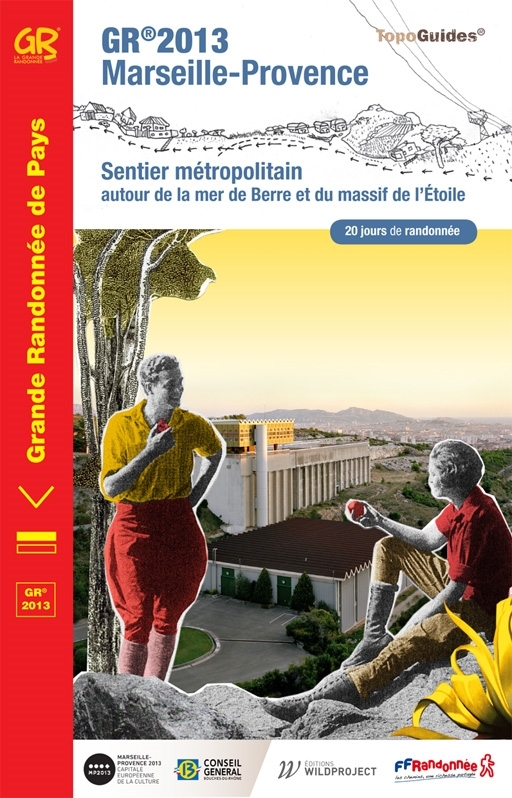
A TopoGuide® from the FFRandonnée
hijacked by the artists of the Walkers Circle
- Description of marked, maintained, secure trails
- Suitable for multi-day trekking, and a backpack
- The essential practical information: stages, accommodation, accessibility.
- FFRandonnée expertise associated with IGN maps
- With many artist-walkers drawings, photographs, texts and maps
The GR®2013 consists of seven sequences of approximately 50 km (2 to 3 days of walking). The route is shaped like a double loop around the Etang de Berre (aka Mer de Berre) and the Etoile and Garlaban mountains, following the idea that “the metropolis is organized around two large voids”.
The signage
The signage
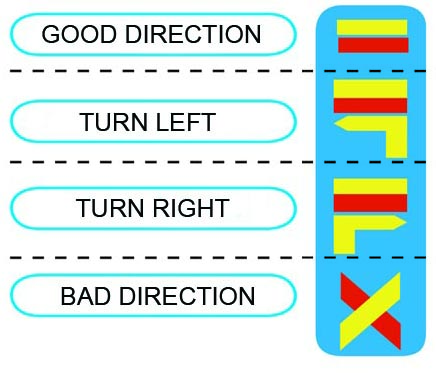
The GR2013 is marked in red and yellow. It corresponds to the charter of the National GRs. In the Bouches-du-Rhône, 100 volunteer trail markers from the Departmental Hiking Committee maintain nearly 3,000 km of signed trails including the GR2013.
The hiker’s charter of the FFRandonnée
Developed with the support of GRTgaz, the aim of the hiker’s charter is to make all users of hiking trails aware of the importance of preserving this environment and respecting biodiversity.
Help take care of the trail
Have you noticed deterioration, signage problems, an environmental problem, a conflict of use ?
Help us to report it to the competent authorities by providing your information on the Suricate platform.
Report illegal dumping with the application on a daily basis or via the Metropolis website.
The route
Organize your trips
The pilot
To prepare your walks and hikes, lepilote.com is at your disposal to identify in real time the bus, Cartreize, TER, TGV routes that you will need for your travels.
Hiking on the GR2013, in complete safety
In summer, forest areas are more exposed to the risk of fire. Also, to protect walkers and sites, access, including by sea or road, and the presence of people and workers in the forest areas are regulated by prefectural decree from June 1 to September 30 and may be by municipal decree. Access, circulation and parking of vehicles except on roads open to public traffic are prohibited throughout the year.
Find out before going for a walk and call 0811 20 13 13 (€ 0.06 / minute) or consult the Access map to the forest areas (updated daily) on myprovence.fr
Insurance
To be covered in its work with the GR2013, the Departmental Hiking Committee offers 2 insurance options:
– As part of a club practice: The federal license
– As part of an individual practice: La Randocarte
Crossing the MUCEM
Please note that the museum is open every day except Tuesday and the hours change depending on the time of year, controls are necessary at the entrance according to visitor regulations. So check the schedules.
Organize your accommodation
At the top of this page, the green pastilles offer a series of accommodations on the GR2013…

